While the main goal of my paternity leave was to bond with Lucy and help out with Grace, I also wanted to get a few projects done in the occasional downtime. Both were somewhat more complex woodworking projects than anything I’d done before, and both were essentially done from scratch, with all of the haphazard nature of construction and roughness of finished project that implies.
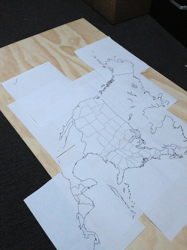
First, I’d long been looking for a United States map puzzle that featured Alaska and Hawaii in their proper scale and correct geographic location. As an Alaskan, I’d long been embittered by the placement of the 49th and 50th states as afterthoughts in inset boxes below California on most U.S. maps, and I wanted my kids to know the truth about where the states are located, and how big and small and remote they are. Given the massive expanse of water between Hawaii and the mainland, and the need to include Canada to give context to the relationship between Alaska and the Lower 48, I could understand why the Geographically Correct Map Puzzle was not a priority for Melissa & Doug or any of the other puzzle makers.
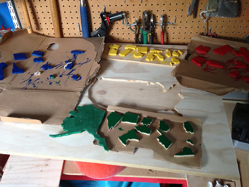
Armed with some online advice on how to make a jigsaw puzzle and a few vector maps of the U.S. and North America, I set out to make my own. First, I bought two sheets of 3/4″ plywood, and transferred the map to the wood with a ballpoint pen. Not a great strategy, but one I could do with the tools at hand.
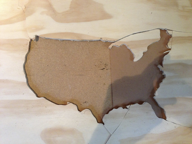
Next, I bought the requisite major tool to accompany this project, a scroll saw from OSH, and set to work making the cuts. It was my first time using a saw like this, and I quickly learned that all of the detailed meanderings of coasts and borders I’d transferred to the wood were about to become meaningless. The scroll saw is pretty magical, but still, it’s tough to maneuver a scroll saw blade around an area that small and full of detail.
So, I began to approximate. Make sure Four Corners are actually four corners. Make sure to include Long Island. Make sure Colorado and Wyoming aren’t the same shape. I quickly realized I’d have to cut in from the edge of the board to get to the coastline, and ended up making a number of cuts which I’d later have to fill in and try to disguise. That work was some of the more problematic and error-prone, and the lumps around British Columbia and Maine attest to my lack of skill in gluing, clamping, filling, sanding, and so on.
In order to fit the map on a roughly 24″ x 24″ piece of plywood, the Lower 48 from west to east ended up being not much more than 12 or 14 inches wide, which means the states get pretty small once you find yourself in New England. So, despite the puzzle having arisen out of a desire for geographical accuracy, I ended up having to fudge on a number of the New England and Atlantic states, making a single piece for Maryland and Delaware, a single piece for Massachusetts, Rhode Island, and Connecticut, and a third single piece for Vermont and New Hampshire. I was happy to have been been able to limit it to that, and glad I didn’t destroy New Vermontshire in the process of cutting it, as the smaller the piece gets, the more likely it is to just be churned up when the blade is put to it.
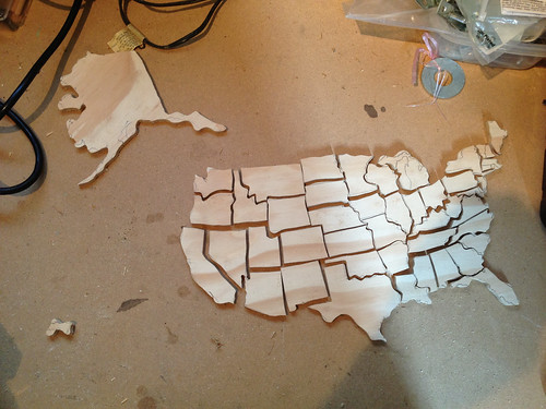
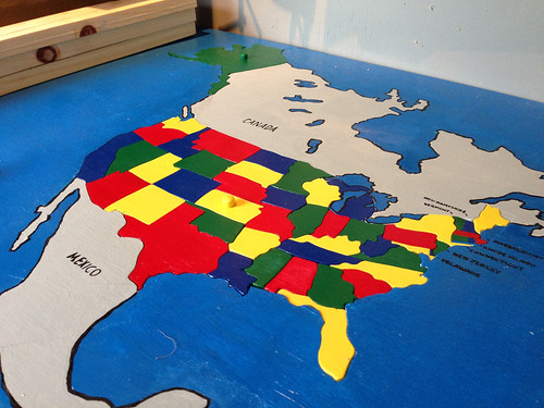
Once I’d cut the individual states, I put them back into my finished silhouette, making sure they fit, and then gave them each a color, trying to make sure no two states of the same color touched one another. Missouri, with the honor of bordering eight other states, created a problem, and shares a tiny bit of border with another “red” state. Oh well. Each state got two or three coats, and waiting for the paint to dry added more time to the project than anything else.
I traced around the states, went over the lines in paint, and did a fairly poor job labeling the states with the narrowest brush I could find. A few coats of white, then blue for the ocean and gray for Canada and Mexico, with a little bit of black outlining and a label, and the project was finished. I added a little handle to get Alaska out, and one for Kansas, as well, to unlock the rest of the states.
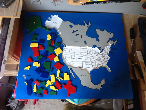
Hawaii still gets stuck occasionally, and I think Florida needs some sanding as well to make it a little easier to remove. Grace likes moving the pieces around, and can identify Alaska, Hawaii, and California. It’s too hard for her to get the pieces back in at this point, but it won’t be long until she can. The whole thing took about three weeks of an hour or two a day, and was a lot of fun to make. I hope Grace and Lucy enjoy playing with it as much as I did making it.